My ideal bike map

      Filed under: Articles   

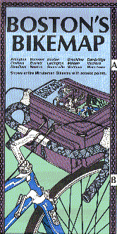
I think you’ll agree that the best driving route from Point A to Point B is not necessarily the best biking route. But when it comes down to characterizing just how good a particular road is for bicycling, things get complicated. While I’ve made good use of Rubel’s waterproof Boston Bikemap, my ideal bicycle map would give me answers to a whole slew of questions:

  • How popular is the road with other bicycle commuters?
  • What are the specific traffic dangers? Car doors? Alleys? Buses?
  • How fast are the cars moving? How much traffic is there?
  • How much space separates bicycle from auto traffic?
  • Who/what else do bikers share this space with? Piles of debris and leaves?
  • Has the road been the site of previous accidents?
  • Is there a bike lane? Do drivers respect it?
  • How smooth is the ride? Do you need to swerve frequently to avoid potholes?
  • How well lit is the road after dark?

What would such a map look like? I’m not sure. I’ve run across attempts at one of these or another:

If you have others, please leave a comment. I’m very interested in leveraging technology to make bicycle commuting more approachable, safe, and enjoyable. A (cycle-specific) mapping and routing system affects all three, so it’s definitely on my radar.


UPDATE (2007.11.30): veloroutes, like bikely, let users share hand-drawn and GPS-generated routes. But neither of these, as far as I can tell, can directly answer my first question. I’d love to see a map that colors streets based on bicycle traffic volume.</p>


UPDATE (2007.12.03): Steve Spindler has posted some excellent comments below. Please take a look!</p>


Comments


sspindler wrote on November 30, 2007
Ari - Here's a quick response to your post about the ideal bike map. I always like it when people think about their ideal bike map. As someone who uses my bike as my daily mode of transportation and designs bike maps, I felt compelled to respond to your blog post. The people making the bike map often have an agenda. For example, a city may want to emphasize the existence of bike lanes. Ithaca, NY emphasized bicycle level of service and terrain. Lancaster Co, did a combination of bicycle level of service and traffic volumes. Washington DC emphasized onroad/offroad facilities and major roads. City of Alexandria prioritized on-road bike routes to help direct cyclists and also made the map information helpful as an educational tool to engineers and planners. There are multiple bike maps for the Philadelphia area that emphasize different conditions relative to the audience that they are targeting. Right now I'm working on a bike map of Fairfax County. It's a huge area that will require a couple of maps to cover the county. What this can accomplish is different than what the City of Alexandria can accomplish on its larger scale map (that has every street named and indexed). This map is being driven by bike commuters working together with the county. I think the premise of the Fairfax map and the Greater Philadephia Bicycle Coalition's bike maps start with "How popular is the road with other bike commuters." It's not economical to evaluate the bicycle conditions for every road. Other roads are studied as well. Road conditions are often assessed using a bicycle level of service model (which doesn't look at intersections). Intersections have to be analyzed separately. Some of the traffic dangers that you mentioned are considered in this model - like traffic speed, onstreet parking, pavement conditions, trucks, and road width. You mentioned the Athens, Ohio map. I think this map illustrates the effect of scale. It's not a big or dense area like a major city. In looking at online mapping potential, one of our conclusions was that bicyclists need a connection to a community of cyclists. One cyclist can share highly local knowledge with another cyclist that is specific to a destination (like, "Cut behind the school tennis courts to avoid traffic on a major road.") Also, we identified that cyclists have different peer groups. For example, some cyclists be looking for acceptable routes for their kids to ride." I think sites like bikely are good services. With regards to bike accidents - I think this says more about the demand for cycling in an area than the safety. If a road is perceived as really bad for cycling, you won't see many cyclists on it in the first place. If a road is perceived as good, the greater number of cyclists may lead to a larger number of car/bike collisions. Some research in the Philadelphia area has shown this to be the case. With regards to riding after dark - Denis Wood has some good ideas. When Wood was a professor, a friend of mine took all of his classes and insisted that her future husband also take Wood's class. Denis doesn't drive and always has an interesting perspective on things. I personally think that well lit streets might have their place but aren't a high priority on a bike map. There's a lot one can do to see better and be seen (day or night). Some of the worst roads for biking are great at 5 am when I'm riding to the boathouse to go rowing. There are things you don't see on bike maps - like the amount of crime in an area. I bike just about anywhere and have been chased a few times by kids who wanted my bike. Also, location really affects how securely you need to lock your bike. Given your interest in technology, I should mention that free tools have really opened up possibilities for making better bike maps. For instance, bicyclists give me their data in kml format that they draw onto mymaps in google and I can import this directly onto a map. With inexpensive/free software cyclists can plan trips to their own preferences. Just to sum up - A bike map has many stakeholders and audiences. I think the ideal bike map is going to be tailored to the location and will prioritize the needs of its audiences. It needs to be clear and easy to read, easy to fold, and accurate. And finally, a map needs to communicate to non-cyclists or potential cyclists that bicycling is a great way to get around. I use the maps I make, and I use online and gis tools to plan my routes as well. I wear a gps on my wrist to track my rides. For someone that uses a bike to take trips to meetings that are say, 15 miles away, it's nice to have a paper map to reference. Steve Spindler

ari wrote on December 3, 2007
Steve, Thanks for your comments. I hadn't thought of map-making as being an agenda-driven activity, so I appreciate your bringing this up. If and when I actually try to compile a map driven by the questions above, it, too, would be driven by an agenda: To show that good A-to-B routing can make bicycle commuting noticeably safer and more enjoyable. Bicycle commuting is primarily a solitaire activity, but I'm sure that many would appreciate the opportunity to share and draw upon each other's experience. The web is a great place for this to happen, which is one reason that I'm drawn to the idea of user-contributed data as an important source of map information. The current crop of web-based mapping APIs have already opened up a lot of opportunities (as bikely and veloroutes both illustrate), and I think these will get even more interesting as the continue to develop. I definitely agree with you that the physical quality of a map can be very important. I've greatly enjoyed the Pocket Rides series covering the Boston area. The compact (and waterproof) form-factor makes a big difference here. I neglected to mention that I heard about Denis Wood's streetlight map via a recently-rebroadcast episode of This American Life.

Ari wrote on March 10, 2010
This just in: Google bike maps

Ari wrote on May 11, 2010
Another great resource, built for SF on top of Google Maps: sfBikeMapper

matti wrote on June 9, 2011
JavaScript for visualizing route and icon layers on Google Map...